


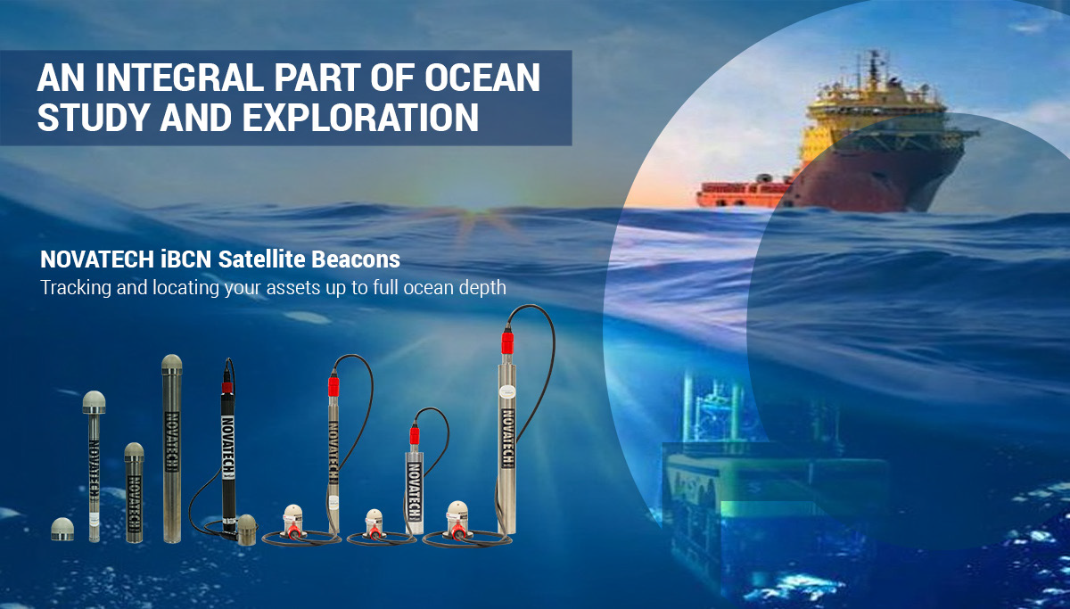
NOVATECH iBCN Satellite Beacons: An Integral Part of Ocean Study and Exploration
The water is unpredictable. Maybe you are an oceanographer, with a sub-surface mooring that you need to keep track of. Maybe you are in the oil and gas industry, with remote and autonomous vehicles working at icy depths. Maybe you have one vessel. Maybe you have an entire fleet.
But what do you do when the unpredictable suddenly happens? When a mooring breaks free unexpectedly or you lose communications with your remote vehicle? How do you recover, and move forward confidently?
“It gives you that peace of mind.” -MetOcean Global Account Manager Evan Aalders.
For many experienced mariners, the only answer is a MetOcean Telematics NOVATECH location and recovery assist beacon. “It gives you that peace of mind,” says MetOcean Global Account Manager Evan Aalders. “When recovering assets, either planned or unexpectedly, a proudly mounted NOVATECH beacon offers a reliable means of tracking your assets’ location.”
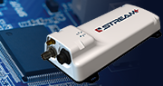
The NOVATECH Beacon Families
The MetOcean Telematics NOVATECH beacons are designed to last in the harshest of ocean environments, and come in what Aalders describes as three families, depending on need. For line-of-sight coverage, flashers are a high-powered visual aid. Used at either the surface level, or attached to submersible equipment, these beacons are especially helpful in dark or stormy conditions. Next up, the radio beacons can transmit their location up to five nautical miles, sending out an RF pulse on a specific frequency. For the most precise location and recovery services, the satellite beacons are unparalleled. With GPS mapping and bi-directional communication, the user is not required to be on-site. Instead, they will receive an email notification when one of their beacons is activated, with a precise location and consistent updates that they can control. “This really is about high-value asset recovery,” Aalders says.
This is where, as he explains, a global satellite network comes into play. Relying on Iridium technology, MetOcean uses 66 low-orbit satellites to provide full coverage, anywhere in the world. The satellite beacons can be used with scientific equipment, remote or autonomous vehicles, and even cabling. However, they are particularly useful in the oil and gas industry.
“This really is about high-value asset recovery”- Aalders.
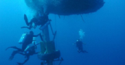
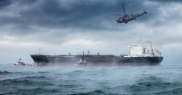
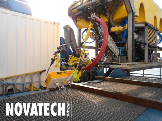
“Most often, they are going on work class ROVs, which are huge, remotely-operated vehicles that can be worth millions of dollars. These machines are going thousands of meters deep in the ocean for various offshore inspection and repair activities, and if the umbilical line providing power and communications is severed, that can cause a serious problem,” Aalders says. “It can take days, sometimes months, for that vehicle to actually surface. It is also likely that it will not surface in the same area it was deployed.” But with a satellite beacon, you will know when a line has been severed, and when the RV comes up again, there is no guessing where it might be. “There is potential for the oil and gas fields to use these beacons on instruments that they may never have thought about, to aid in recovery or act as an insurance policy.”
Oil and Gas Companies Get Creative with Satellite Beacons
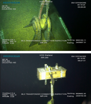
Companies, like BW Offshore, are already finding innovative uses for the satellite beacons, utilizing the Iridium technology to its fullest. By attaching beacons to pipeline cabling, BW Offshore has been able to isolate specific sections of their sub-surface work without having to do physical inspections. “Traditionally, you would only know there’s been a break when you saw the cable come to the surface with a float,” Aalders says. “This is basically giving them a real-time identification about which beacon has pinged, and at which depth, so they can start working immediately to plan repair and recovery operations.”
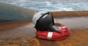
All NOVATECH beacons are rated to 7,500 meters in depth, with the Infinity series able to reach full ocean depth at 12,000 meters (developed for James Cameron’s Challenger Deep mission, exploring the Mariana’s Trench). While the ratings are impressive, what it translates to is time saved. “Iridium was a real game changer,” Aalders says, in part because of the bi-directional communications. “We can actually set internal geo-fences so if the device goes into a certain area, you will get an alert. And you have the ability to send a message back to the beacon, to adjust the reporting frequency.” The ability to change the beacons’ reporting interval leading up to and during recovery offers customers a means of managing costs and coordination time.
The key to the communications is the LINC software that MetOcean Telematics provides. “Anywhere you have internet access, you can log on to LINC,” says Aalders. Because the messages that the Iridium network sends out are safely encrypted, this software tracks and fully decodes the information once it is received. “It also allows users to plot the GPS positions from those beacons on the built-in map. Not only can you physically see the beacons’ positions in the software, you can also forward those decoded GPS positions to an Iridium handset or your cellular phone.”
A Company Focus on Custom Solutions
This is the type of client-focused solution that MetOcean Telematics thrives on. There is a company focus on niche solutions and developing custom products within the satellite communications industry. The head office in Dartmouth, Nova Scotia, Canada allows incredible access to both the Bedford Basin and the open ocean, providing engineers with a test facility that cannot be replicated in any lab. Satellite offices around the globe also provide 24-hour customer support. It’s these factors which allow MetOcean Telematics to dive into product research and data collection, working with both the military and the commercial oceanographic market.
Whether you are working with a small buoy or a fully autonomous vehicle, it is valuable. Aalders says his team works to come up with the perfect beacon solution for each individual client. The oceans are deep, dark, and mainly undiscovered. NOVATECH beacons are the lifeline.